📜 Understanding Legal Descriptions in Land Surveys
Florida Building & Land Surveying | Rick Morales, P.S.M.
When purchasing or selling real estate in Florida, the legal description on your land survey is one of the most important details of the entire transaction. Every title agent, lender, and closing attorney in Miami-Dade, Broward, and Palm Beach Counties depends on that description to confirm exactly what property is being bought or sold.
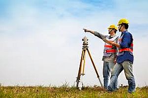
At Florida Building & Land Surveying, led by Rick Morales, P.S.M., we specialize in precision land surveys that ensure your legal description is accurate, complete, and legally defensible — protecting buyers, sellers, and title agents from costly mistakes.
📍 What Is a Legal Description?
A legal description is a formal written way to identify the exact boundaries and location of a property. Unlike a street address, which can change or repeat, the legal description defines the land using survey measurements, township grids, and reference monuments.
Every parcel of land in Florida — from Downtown Miami to Fort Lauderdale Beach and West Palm Beach — is part of an established grid system of townships, ranges, and sections.
The legal description uses this data to pinpoint the property’s unique position on the map.
You can learn more about property grids and survey standards at www.FloridaLandSurveying.com.
🧭 The Land Survey Expert Explains
According to Rick Morales, P.S.M., Professional Surveyor and Mapper at Florida Building & Land Surveying,
“A Land Surveyor does not rely on a street address to perform a survey. Addresses can repeat or be incorrect. The legal description tells us exactly where a property begins and ends, referencing specific monuments and control points that define its true location. Surveying a property based only on the address can result in an inaccurate or invalid survey.”
Rick and his team have completed thousands of surveys across South Florida, from luxury estates in Coral Gables and Miami Beach to condominiums near Las Olas Boulevard in Fort Lauderdale and residential developments in Boca Raton and Palm Beach Gardens.
⚖️ Why the Legal Description Matters
The legal description is a unique identifier of your property — it’s what ensures you’re buying the right piece of land.
If the description doesn’t close properly (meaning its start and end points don’t meet), the property’s boundaries are legally incomplete.
Errors in legal descriptions can lead to:
-
Incorrect deed recording
-
Title disputes between neighboring properties
-
Delayed or cancelled closings
-
Costly litigation requiring court intervention
That’s why every title agent and real-estate attorney — from Brickell to Weston and Palm Beach to Pompano Beach — relies on a licensed land surveyor like Florida Building & Land Surveying to verify accuracy before closing.
🏢 The Title Agent’s Role
Title agents use the legal description from your land survey to:
-
Verify that the deed matches the correct parcel
-
Confirm that property boundaries “close” mathematically
-
Ensure that mortgages and easements are properly recorded
A professional survey is the only reliable way to confirm that the legal description aligns with the property’s actual boundaries.
This step prevents confusion and keeps buyers and lenders protected.
🧾 Types of Legal Descriptions
In Florida, you’ll most often encounter three main types of legal descriptions:
-
Lot and Block:
Common in subdivisions and recorded plats. The survey identifies the lot and block numbers and references the official plat map filed with the county. -
Metes and Bounds:
Describes a property by its bearings and distances, outlining each side of the boundary in a continuous loop until it closes. -
Fractional or Government Survey:
Used primarily in rural or undeveloped areas. It describes the property as a portion of a section, township, and range, referencing government survey corners and monuments.
Each type requires careful calculation and mapping — something Rick Morales, P.S.M. and his team perform daily using GNSS (Global Navigation Satellite Systems) and drone surveying technology for maximum accuracy.
🚁 Precision Mapping with GNSS & Drone Surveying
Modern legal descriptions demand cutting-edge accuracy, especially in fast-developing regions like Miami-Dade, Broward, and Palm Beach.
Our team uses GNSS satellite surveying and aerial drone mapping to:
-
Capture precise coordinate data for each boundary corner
-
Create accurate topographic and elevation models
-
Document features such as seawalls, driveways, and easements
-
Deliver certified plats accepted by title companies and lenders statewide
Whether surveying commercial towers near Brickell Avenue, residential lots in Hialeah and Pembroke Pines, or waterfront properties along Las Olas and Biscayne Bay, our advanced equipment ensures every legal description is precise, complete, and legally valid.
🌴 Serving All of South Florida
From Miami-Dade County — including Miami, Coral Gables, Aventura, Doral, Hialeah, Kendall, and Homestead —
to Broward County — including Fort Lauderdale, Hollywood, Weston, Pembroke Pines, Davie, and Pompano Beach,
and north through Palm Beach County — including Boca Raton, Delray Beach, Wellington, and Palm Beach Gardens —
Florida Building & Land Surveying is trusted by homeowners, attorneys, and title professionals statewide.
📞 Contact Florida’s Legal Description Experts
Before you close on your next property, make sure your legal description is correct — and your survey is completed by a licensed professional.
📞 Call 877-894-8001 or visit www.FloridaLandSurveying.com
Florida Building & Land Surveying – Led by Rick Morales, P.S.M., Florida’s Trusted Surveyor for Legal Descriptions, Drone Mapping, and GNSS Precision.